
Skyline maps
City skylines are one of my favorite types of scenic view. When planning to visit a new city, or even when looking to take some photos of a familiar city, I like to do some online scouting of good spots for a skyline view. I can recall several years ago browsing Google Earth, panning around and tilting the view to see terrain and guess at good vantage points. But by now Flickr users probably have just about every vantage point covered, so a more fruitful search can be done by looking at geotagged photos.
Out of curiosity I threw together some maps to show where most of the skyline views are, as defined by photos tagged “skyline” on Flickr. They are done in a sort of heat map style where brighter red and yellow indicates a higher density of photos, but they are neither real heat maps nor real density surfaces; rather they are many overlapping, mostly transparent dots, blurred a bit and mapped to a heat-like color gradient. There are no great insights that you can’t get from searching Flickr’s own maps, but it’s not bad for purposes like mine. I even learned of a new spot to check out locally; so it totally worked!
Here are some of the most photographed cities in North America, according to these guys. I did skip a few, but they tended to lack enough “skyline” tags to make for an interesting map.
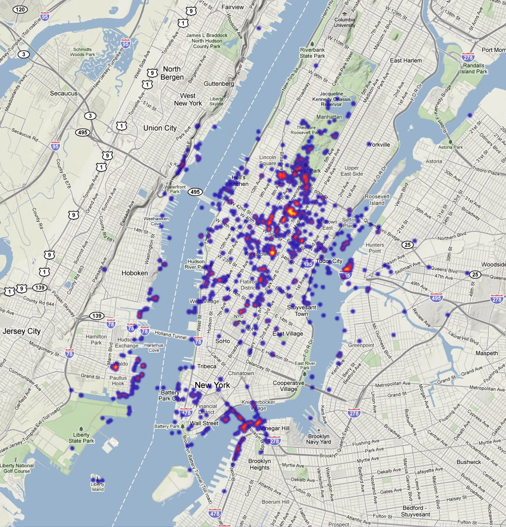
New York: The brightest lights here are observation decks (the Empire State Building and Rockefeller Center), where one can view the skyline from the sky’s perspective. New York has such an abundance of skyscrapers that it’s difficult to take in the whole skyline at once from the ground, but that’s no reason not to see the views that people are favoring along the East and Hudson Rivers.
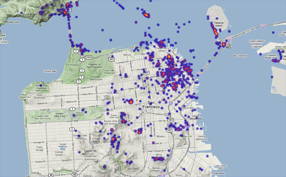
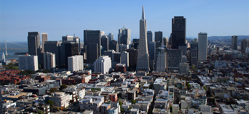
San Francisco: This city is made for scenic urban vistas. I recognize Coit Tower and Alactraz here, and can see that Treasure Island affords a nice view, but there are also some concentrations closer to the center of the peninsula that are beyond my knowledge of the city.
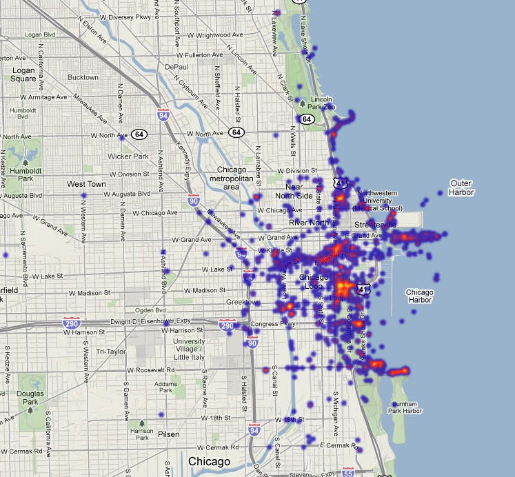
Chicago: All things considered, Chicago gets my vote as the best skyline in the country. There are several predicable popular spots here, such as the Museum Campus, the Sears Tower (or whatever it’s called now), and the John Hancock Center. But most interesting is the hotspot on Millennium Park, and specifically on the Cloud Gate sculpture, a.k.a. “The Bean.” This is presumably one of the only spots among any of these cities where the majority of skyline photos are of a reflection.
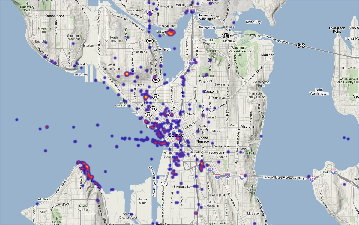
Seattle: Seattle gives San Francisco a run for its money in terms of ideal scenic geography, with lots of hills and coastline. Head to Gas Works Park, the Space Needle, Queen Anne Hill, or, um, that area along the water to the southwest whose name I don’t know. Interesting to note here, as well as in San Francisco, are series of photos that follow ferry routes.
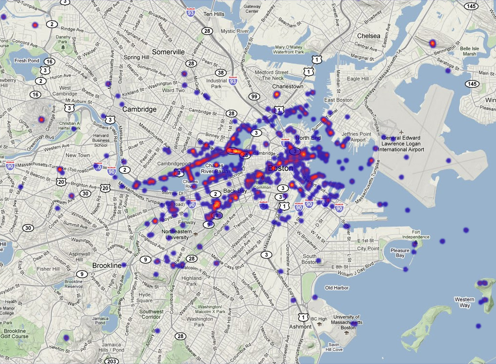
Boston: It’s a difficult skyline, with the two tallest landmark skyscrapers being in an otherwise smaller section separate from the main downtown skyline. Nevertheless there are views to be had. The Prudential tower and the Longfellow Bridge stand out the most here, the latter probably because its panoramic view is so often seen from subway trains coming up for air as they cross the river. Looks like people aren’t fully appreciating the glory of the BU Bridge, though.
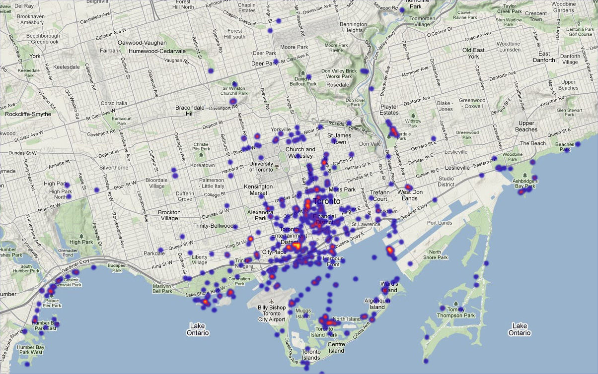
Toronto: Toronto’s skyline has the privilege of being visible at great distances across Lake Ontario. Locally, though, the CN Tower is brighter than anything else on this map, but there are also some notable spots along the water’s edge in various locations. Of all the cities here Toronto is probably the least familiar to me; perhaps some readers can identify locations on this map.
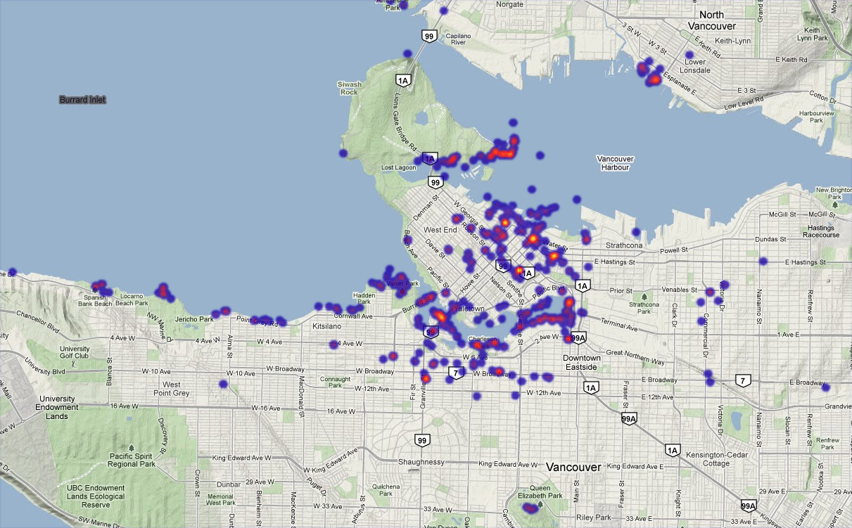
Vancouver: My recollection is that Vancouver’s skyline is expansive but not terribly distinctive. But like the other west coast cities, its topography and coastline provide vantage points. The brightest points on the map are actually on land near the downtown area, but views across various water features prevail overall. I know the Stanley Park views and a couple of those to the west, but am otherwise unfamiliar.
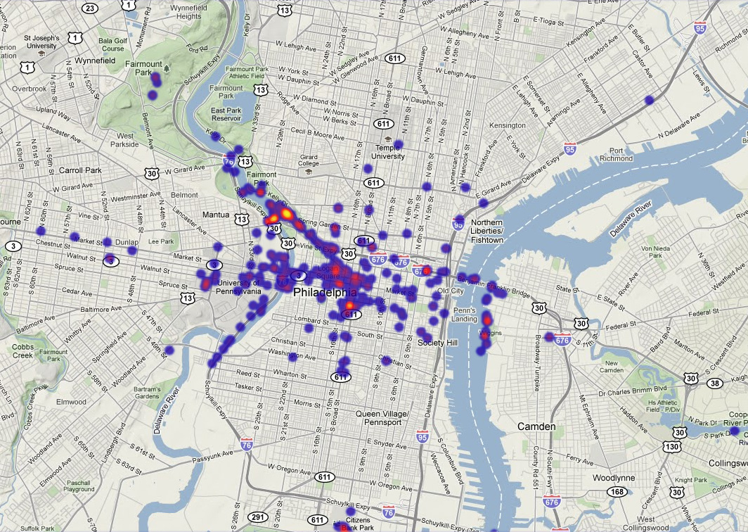
Philadelphia: Of course the favored view is the one from the art museum, and of course all those photos are of somebody doing a Rocky impression.
Tagged Boston, chicago, cities, flickr, new york, philadelphia, san francisco, seattle, skylines, toronto, vancouver
11 Comments