Longtime listeners know that Tim Wallace and I had a good run of mapping all manner of things about Boston and environs on the Bostonography blog a while back. (It's not exactly active now, but technically is still alive.) We've always dreamed of producing a Bostonography book to grace coffee tables. Alas, it's a pitch and commitment we've been unable to make.
Sometime after the Bostonography heyday, Belt Publishing's "50 Maps" series formed, beginning with a book about Cleveland, followed by one on Detroit by Alex Hill, whose DETROITography took some inspiration from Bostonography, and one by Vicky Johnson-Dahl who—c'mon, do you even know Vicky?—of course did one about Buffalo. In 2023 at the NACIS conference in Pittsburgh I attended a panel discussion featuring the cartographers of those three books and Anne Trubek, the Belt founder and publisher. (The book series has since expanded to Pittsburgh, Columbus, Cincinnati, and the Great Lakes, with more to come.) Wow, I thought, what a great concept. Too bad it's only about Rust Belt cities.
And then out of nowhere the following summer, Anne emailed me, asking if I'd be interested in contributing to the series, including "perhaps a book version of Bostonography (we are interested in broadening our regional reach)." Easy yes.
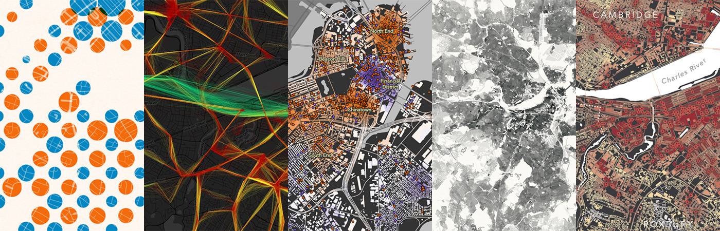
A selection of Bostonography maps by Tim and me.
I started on the book in earnest once my work on Cincinnati in 50 Maps was winding down. You'd think I'd have already had an easy list of 50 or 500 map topics, but no, I had to think! In the end, only three maps from Bostonography went more or less directly into the book, plus a couple of new maps derived from Bostonography posts. I only considered Bostonography maps that were my own work (not Tim's or a collaborative effort), and among those most don't have the general appeal that—hopefully—even tourists would buy.
In addition to the Bostonography maps, there was a certain essential set of Boston maps that I had in mind at the outset, ranging from the history of landmaking in Boston to, of course, some kind of Dunkin' map. Other maps along the way came from exploring public data sets, from random news stories that brought topics to mind, from subjects carried over from the Cincinnati book, and from a few ideas mentioned by friends and family.
No city can have its whole tale and all its people represented in 50 maps, and certainly not a city with one of the longest historical records in the United States. Instead I've done my best to include the essential stuff—historical topics, demographic overviews, and such—and an array of maps that appeal to different interests in Boston. I did want to represent the things for which Boston is famous to outsiders. I also wanted to represent the lesser-known things that only locals will truly appreciate, or that they didn't know about at all.
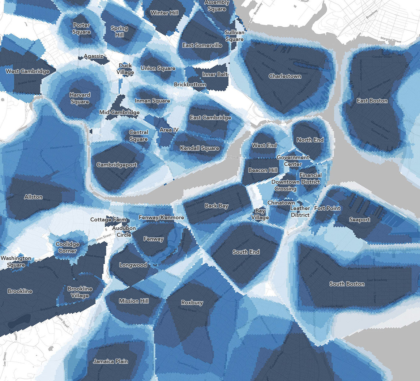
Bostonography's slightly famous neighborhood (dis)agreement map is one that made it into the book.
This book was fun to make. I learned some new things about Boston and rekindled some old interests. When I was a little younger and a lot more child-free, I often took long walks through various parts of Boston and surroundings, getting to know just a bit about each place. When I turned in the draft of this book, I finally set aside an afternoon for a walk again.
Boston in 50 Maps is sort of Bostonography in book form, but it is not the Bostonography book—not least because Tim wasn't able to take on the project with me. The "50 Maps" books are a bit of a cartographic speed-run through their cities, and at this point tend to conform loosely to a certain set of themes. The book doesn't necessarily match the style and subject matter of collaborations between Tim and me. Who knows if we'll ever pitch the Bostonography book of our dreams, but we're holding open the possibility.
Maps!
Enjoy a handful of sample maps from the book below, and please buy the book for anyone you know who loves or lives in the Boston area!
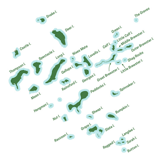
The Harbor Islands
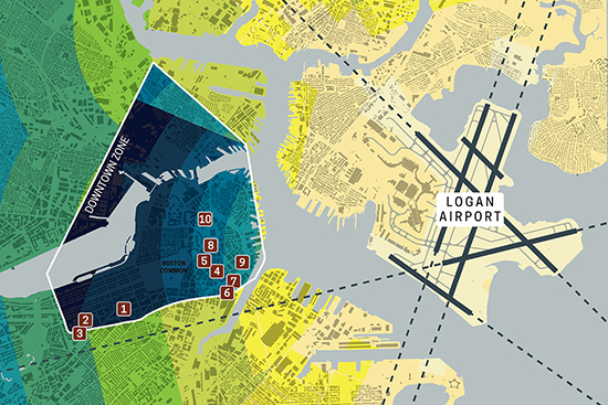
Logan airspace building height restrictions
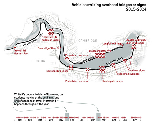
"Storrowing" incidents
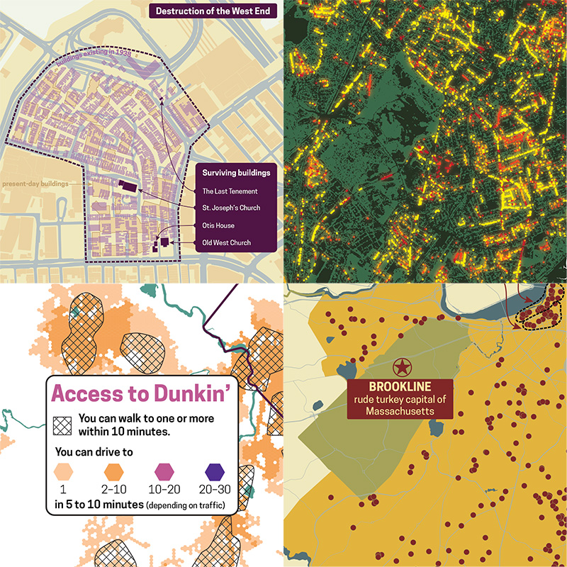
And snippets of others. Don't worry, of course there's a Dunkin' map.