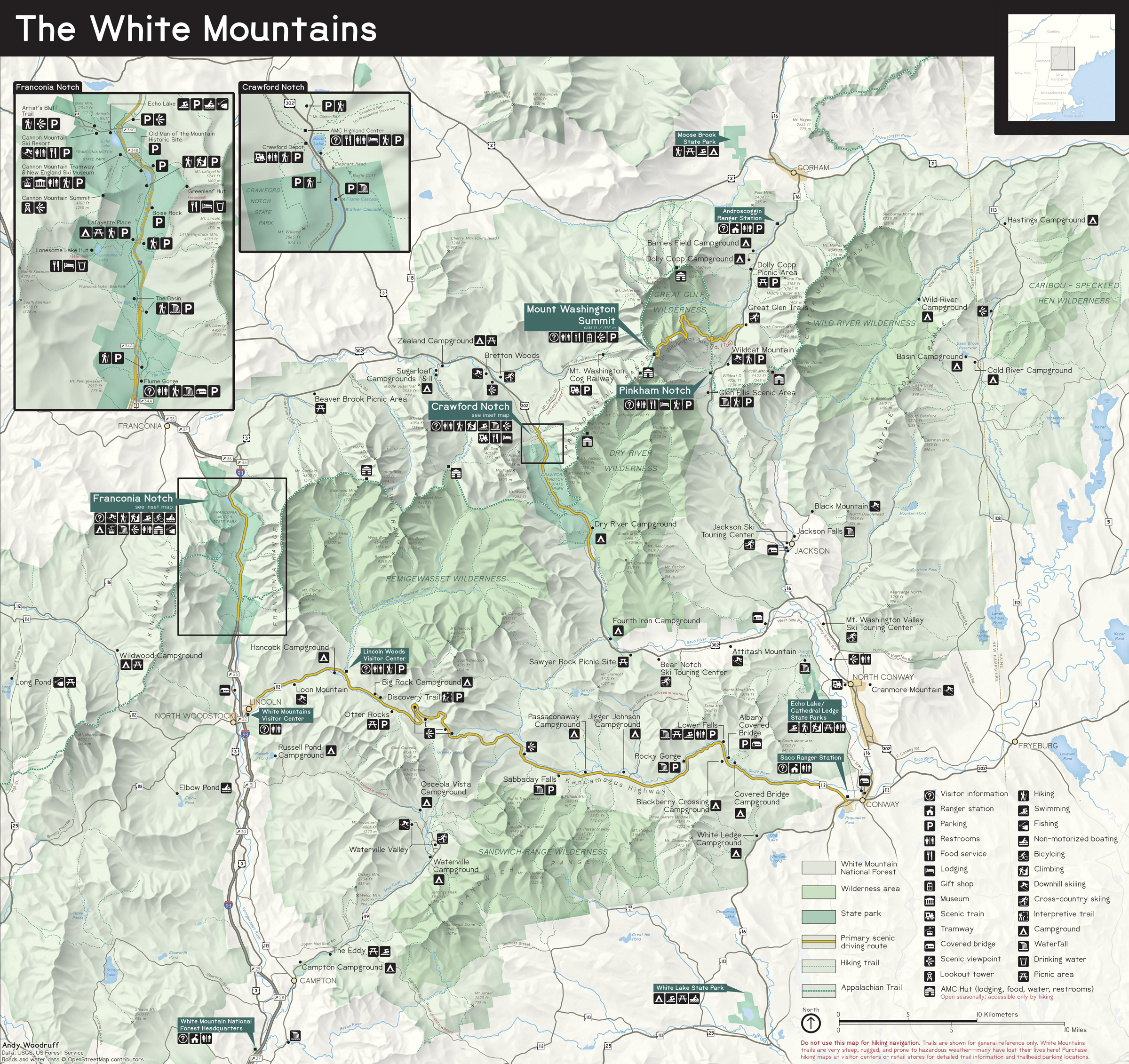
The White Mountains (in New Hampshire and a bit of Maine), the site of many of my memorable outdoor adventures and life events in the last decade or so, are not a national park. Most of it is part of the White Mountain National Forest, managed not only for conservation and recreation but also for its timber resources. But the region boasts scenery, recreational opportunities, and visitor numbers on par with many US National Parks. It's a popular destination year-round (perhaps except spring "mud season"), and, understandably, is sometimes mistaken for a national park. By most visitors, it's used like one.
It's made me wonder: what would the visitor map of the White Mountains "National Park" look like?

Some of my photos from this area during each season
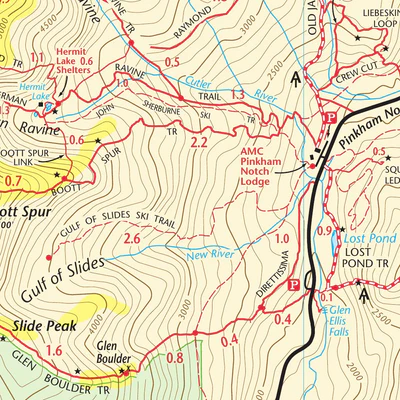
Trail map by Map Adventures
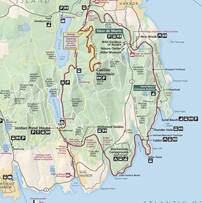
Acadia National Park map
Most White Mountains maps I've run across are either simplified commercial tourism maps or thoroughly detailed reference maps with elevation contours, hiking trails, etc. I'm grateful especially for the latter—the one by Map Adventures has seen more use than any other paper map that I own—but National Park Service (NPS) maps are explicitly not hiking maps.
I'm talking about the map brochure they hand you at the entrance gate. Besides the general lay of the land, it shows a "greatest hits" set of facilities, physical landmarks, and attractions. It primarily covers what's reachable by car (or whatever the typical mode of transport is for visitors), usually not by foot. Perhaps because there's no single agency managing the whole "park" area—some important parts are New Hampshire state parks, and others are in neither the national forest nor state parks—I haven't encountered a White Mountains map with that kind of clear, unified view of the main features.
My quest, as means to get back into practice with print-style mapping, was to attempt a map that a casual or first-time visitor to the White Mountains might find useful. This was a "copy the masters" type of exercise, taking symbols and a lot of other design elements directly from NPS maps, which are freely available, assets and all.
For the cartographically inclined, below will be a rundown of some elements of this map.
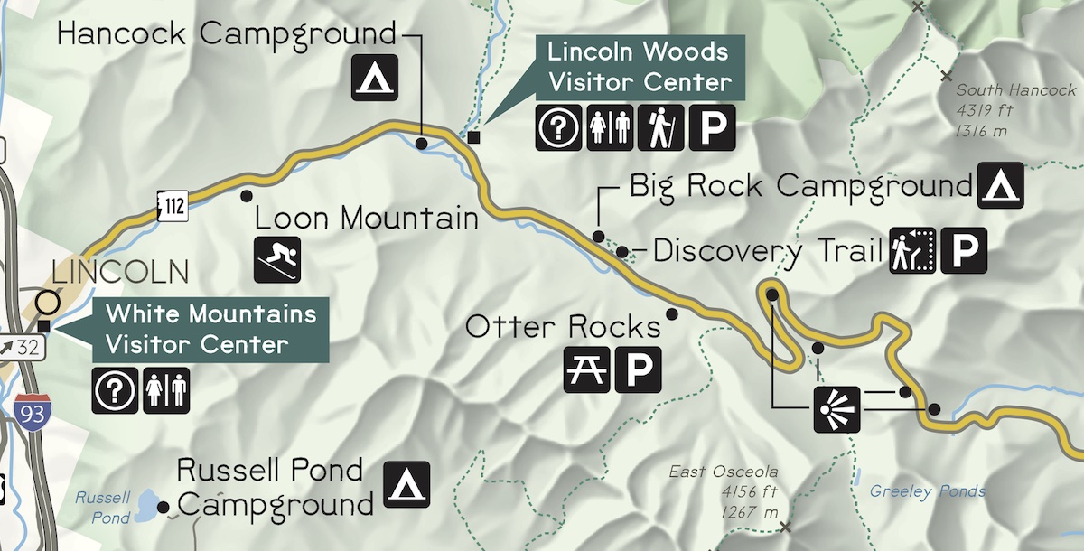
From my map, some points of interest along the Kancamagus Highway
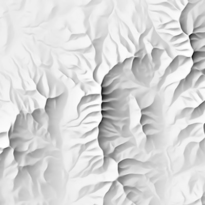
Shaded relief
I started a basic layout of this map some time last year with a shaded relief image rendered with Blender. It was nice, but when Eduard (named for Eduard Imhof), which produces "Swiss-style" shaded relief that almost looks hand-drawn, was released I was eager to give it a try. I think it works perfectly here! Blender is great if you want something to feel a bit like real life, but more generalized relief is better if you want it to feel like a map. If you make maps and have a Mac, I strongly recommend Eduard!
Eduard's capability first to generalize the terrain, and then to emulate human decisions about how depict its shape, can produce shaded relief that works better here than a fully detailed 3D scene from Blender. While the mountains are certainly a major feature (it's in the name!), it's their general location and character, not realism and fine details, that are most relevant to the wayfinding and point features of this map.
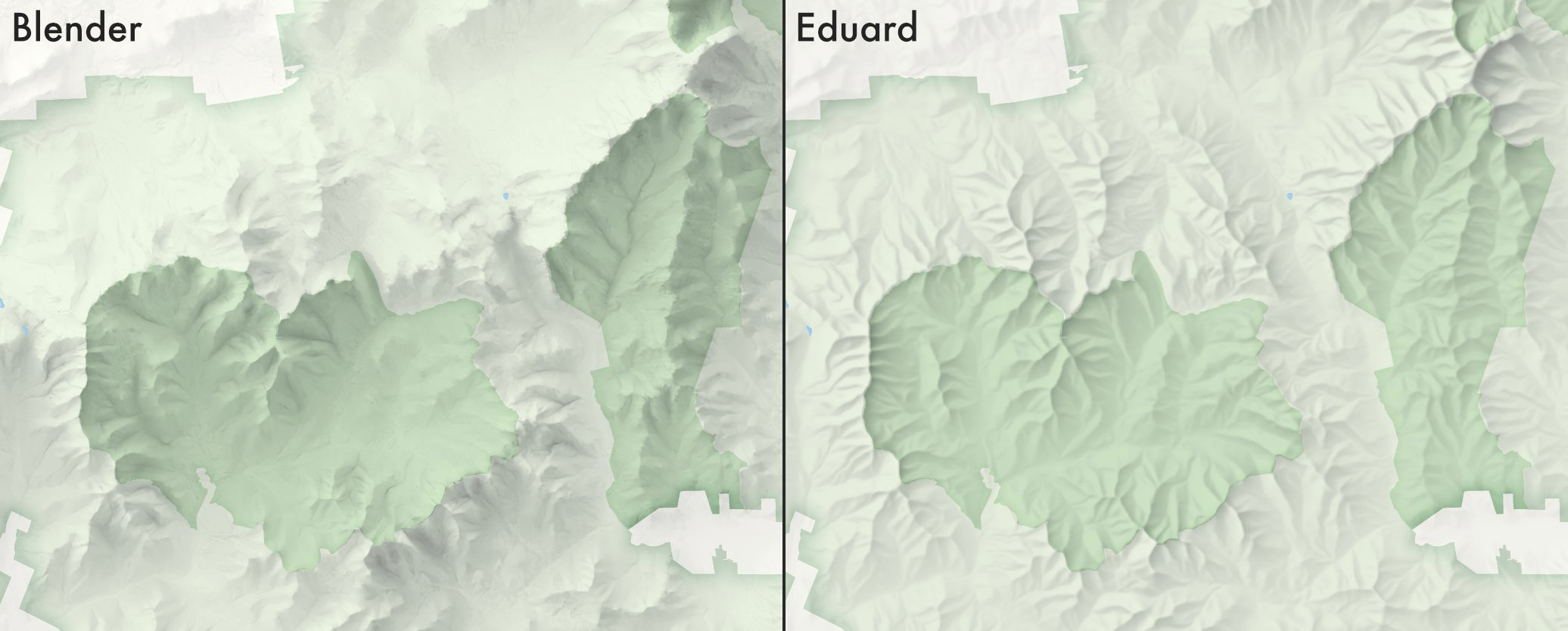
An initial comparison of Blender and Eduard shaded relief for this region
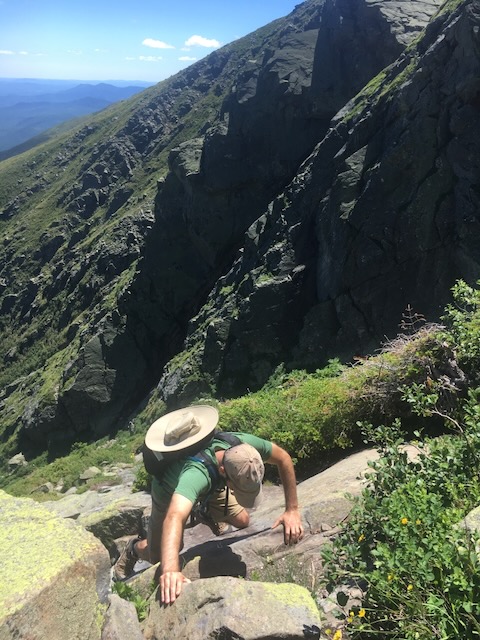
Me "hiking" on a trail
Physical features
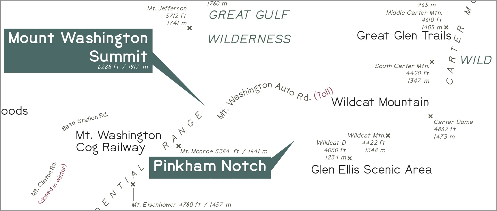
The set of physical features, by which I mostly mean labeled physical features, is far from comprehensive. It's a map of what's easily accessible, and a lot of the notable physical features are not easily accessible. They're limited here to rivers, some lakes and ponds, mountain ranges, and mountain summits. Summits include mountains among the "four thousand footers" list which are the "big" mountains around here, and the "52 with a view" list, which are smaller mountains that offer rewarding views. A general trail network is shown, but again, this is not a map telling you how to get up these mountains; rather, it's more of a suggestion to look up the hikes.
Please try not to laugh at the size of our mountains. They're still beautiful, and the hiking trails are unforgiving. (Switchbacks? No time for that!) A hike here makes for a challenging and rewarding day.
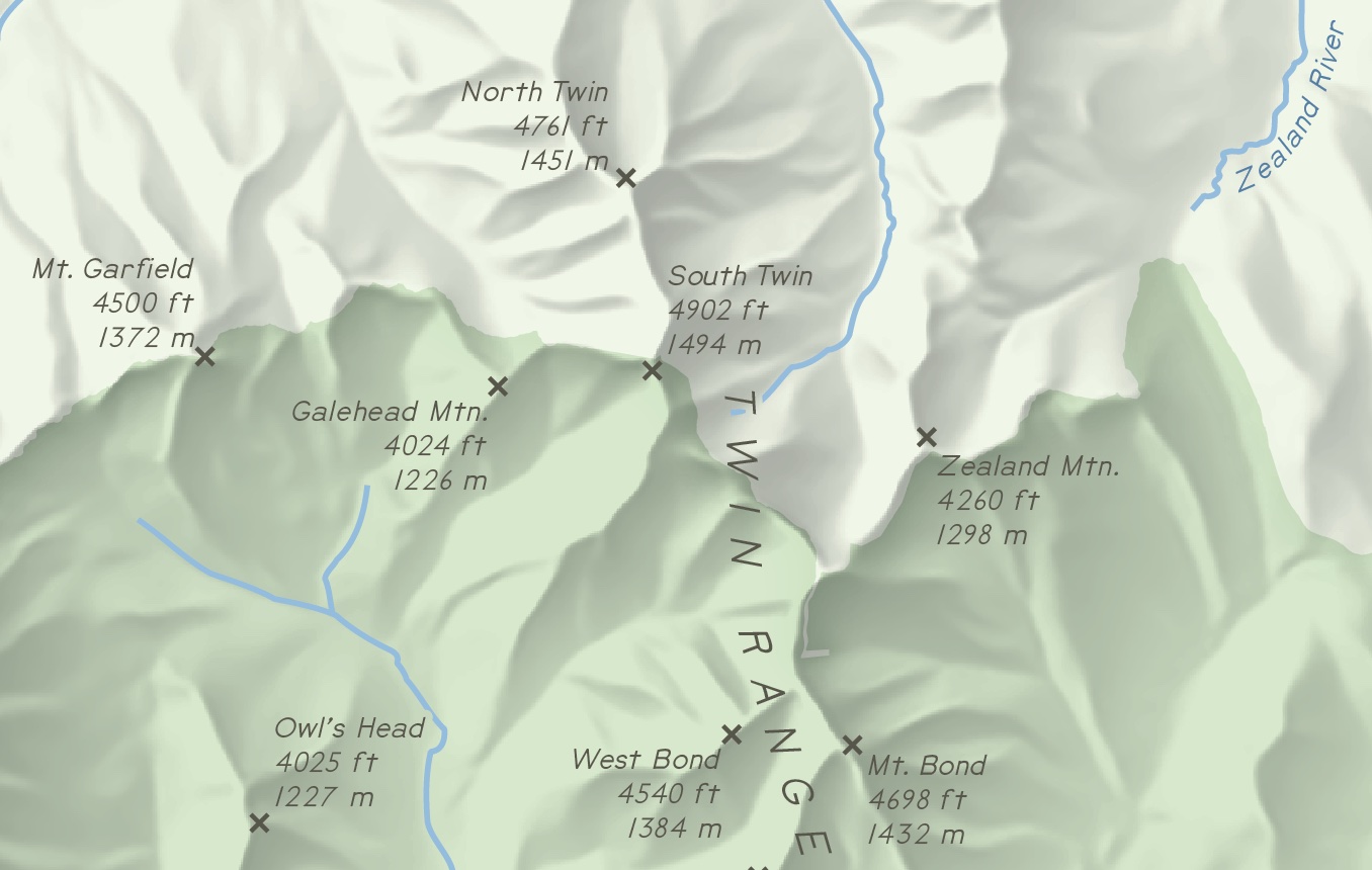
Screenshot of some of the physical features and labels
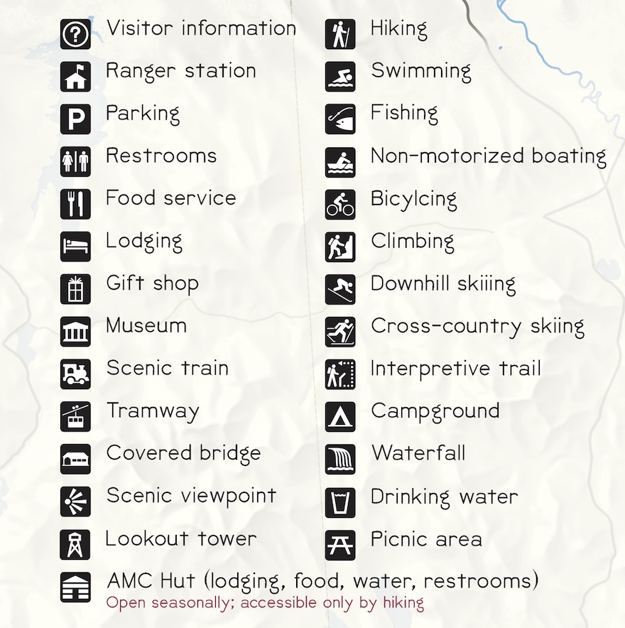
POI categories from the map legend
Points of interest
As mentioned earlier, the focus is on the main facilities, attractions, and recreation sites that are easily accessible (by car). So there are visitor centers, campgrounds, picnic areas, scenic overlooks, and all that. While almost everything here is operated by a public entity (federal or state), there are a couple of notable exceptions. One is privately run ski ares, becuase skiing is the big winter activity here and seems worthy of inclusion. Another is some facilities run by the Appalachian Mountain Club: the mountain huts and a couple of "basecamp" lodges.
I'm sure I missed sone imporant things, but decided to call it quits and hit "publish" eventually (it's not a real visitor map after all), but if anyone cares enough to examine the map and finds something wrong or missing, let me know!
Typography
NPS maps use Frutiger, a license for which is not within my budget for a "just for fun" map. Instead, this seemed like a good opportunity to use BellTopo Sans by Sarah Bell, which is inspired by USGS topographic maps. It gives this map a bit of a different feel from NPS maps, but being an outdoorsy typeface, it works well and looks good. Sarah continues to work on typeface design (not to mention beautiful cartography), so be sure to follow her work!
Map labels showing various styles of BellTopo Sans
The whole thing
Anyway, here's the full map!