Geodancing
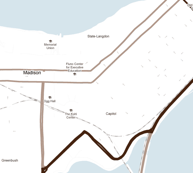
The other day Axis Mapper Dave was working with styled maps in the Google Maps API and made a brief styling mistake—all the small roads disappeared but their one-way arrows remained.

It was actually kind of an interesting perspective on the street system, a stripped-down view of engineered traffic patterns or perhaps a measure of the confusion facing unseasoned motorists. Sure enough that same evening saw me driving in circles because of one-way streets in a place where I’d ordinarily be on foot. And in Madison, Wisconsin, pictured above, in spite of the relatively few arrows on the map it can be surprisingly complicated to cross the isthmus if you don’t start from the right spot. Anyway, with these thoughts in mind naturally I stole Dave’s styling code and tried to blank out everything else to leave nothing but arrows from one-way streets.
Unfortunately it doesn’t seem possible to do this completely with the Google Maps style options, and my samples below involved a little editing to remove yellow streets. I couldn’t figure out a way to make the “arterial” category of streets white without also turning their arrows white. Cloudmade‘s style editor, meanwhile, can do that but can’t yet remove street labels. This bare-bones map is the best I could do with Google Maps; the arterial streets are just turned off entirely, leaving a mostly white-and-arrows map at the largest scales.
Whereas I have previously tried to make a map into a musical instrument, I picture these maps as dance steps. It looks easy to do the Brooklyn, but it’d take some skill to dance the Paris. I’m not about to try it myself, but when geography-based dancing sweeps the nation, I demand royalties!
Pictured at top: dance steps in the sidewalk on Broadway in Seattle, by Flickr user DrewToYou.
Tagged driving, google maps, minimal maps, one-way streets


3 Comments