
Cartographic Summit 2016
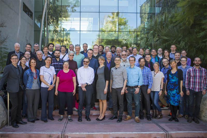
In the official Cartographic Summit photo above, I’m the robot on the right edge who doesn’t know how to stand like a normal human. I’ve just returned from this unusual event, which was part traditional conference and part unconference, with people in attendance only by invitation. I didn’t know what to expect, but figured a few days with friends new and old in sunny Redlands, California in February couldn’t hurt.
The point seemed to be to discuss and identify key areas of focus and/or research for cartography in the near future. A handful of excellent speakers got us going, but much of the main event revolved around small discussion groups which met to talk about challenges and ideas along certain themes and keywords, subsequently summarizing the discussions for everyone else to hear. Surprisingly these were very engaging, forward-facing, and dare I say somewhat fruitful. Usually traditional cartographers talking about Cartography Future only want to fix what’s wrong with Cartography Present, and blame it on those who don’t know Cartography Past. Less so this time.
Altogether it was pretty interesting, and I was mostly pleased with what transpired. Below is a short list of words and phrases that stuck in my mind. Some are good and some are bad. A few are my own thoughts but most paraphrase what I heard. Many are open questions, but that’s okay. Part of the idea here was to develop agendas. Do check the #cartosummit hashtag on Twitter for many more reports, and watch for audio and slide recordings to be posted.
AUDIENCE. We were traditionally taught to understand our audience before designing a map, but we may be falling behind these days. We don’t always think enough about how our maps will be used in the wide variety of possible media and environments. And the internet being the internet, sometimes a map escapes our control and goes far beyond its intended audience. Related to this, there was some discussion about making better use of tracking and analytics, and making such capability easier in our tools.
BIG DATA, SMALL MAPPING. Big data isn’t entirely new. People mapped massive data sets ages ago, but in those days it was usually done by large organizations with lots of people and resources. These days the entire job often falls to an individual. What are the consequences of this, and how can we as cartographers address such a challenge?
BLACKLIST. Although this event was hosted by Esri and organized in part by Esri people, it was in large part an ICA event and Esri attendance was very limited. But for an intellectual meeting about the future of cartography, there was a conspicuous absence of representatives from certain major players in mapping—companies that are in some degree of competition with Esri. Rumor was that inviting them was denied by the Esri powers that be. I’ll take it back if that’s not true, but if it is, it sours the experience a bit for me.
CLARIFY. The best-remembered word from the inimitable Nigel Holmes this week. It’s understood that a vital role of a cartographer is to find and make clear some aspect of data, not simply throw all the data at everyone. This was especially emphasized in discussions of mapping “big data.”
COMPUTATION. What is the role of computation in cartography? It’s more than the hard work of crunching through data. We should embrace it as part of the design process, not as something that detracts from it. If there is one thing I would stress to modern big-C Cartographers, it’s this.
DIVERSITY. This was definitely a white male, people-like-me meeting. At the very least, clearly in a group of 50, there ought to be more than 11 women. Diversity is something we need to improve in the cartography community in general, not only in the sense of gender, ethnicity, etc., but also in things like educational and economic background. Most people who actually work with maps don’t come from the world of advanced geo-degrees that we tend to deal with. (Side note: we’re working on some plans for this at NACIS.)
ELITISM. I appreciate an effort to bring together top minds in cartography (plus a few of us internet loudmouths) and the huge benefits of smaller group discussions, but in a field as collegial and small as ours it leaves many people spurned and furthers an elitist reputation we have among some segments. A few poorly contextualized tweets make it look like we’ve only gathered to continue picking on the new kids. I really don’t know how to be limited, representative, and diplomatic all at the same time, but there is probably some ground to gain here.
EXCITEMENT. Cartographers are in an enviable position to make other people excited about their own domains. The smartest people in the world can have their minds blown by seeing something they’ve studied for years mapped for the first time. We can do good for other fields at the same time as our own.
FAST AND GOOD ENOUGH. Let’s recognize that many modern map users and map makers want to accomplish something in mere seconds, not through a slow series of decisions. We can do people a great service by getting as far as possible with smart, automated decisions. The result will never be perfect, but it’s worthwhile.
MAP LITERACY. How can we better teach ordinary map readers to look at maps critically, to understand their limitations and biases rather than taking everything as unqualified truth? There was, at least, some sense that people are getting better at recognizing good cartography, which is nice. I’d rather help people become better map readers than worry about a proliferation of bad maps.
SKIPPING. Yeah, so I ditched most of the third day to go to Joshua Tree National Park with [names redacted to protect professional reputations] instead.

4 Comments